Hello,
In this post, let's explore how to use the "Clip" feature to cut out desired areas from the vector layers.

When working onmaps, there are times when we want to remove unnecessary map areas and focus only on the required ones.
Alternatively, if there are unwanted values in the attribute table, it may hinder proper analysis.
In such cases, the "Clip" feature comes in handy.
For vector layers, you can find the Clip feature under:
Vector > Geoprocessing Tools > Clip
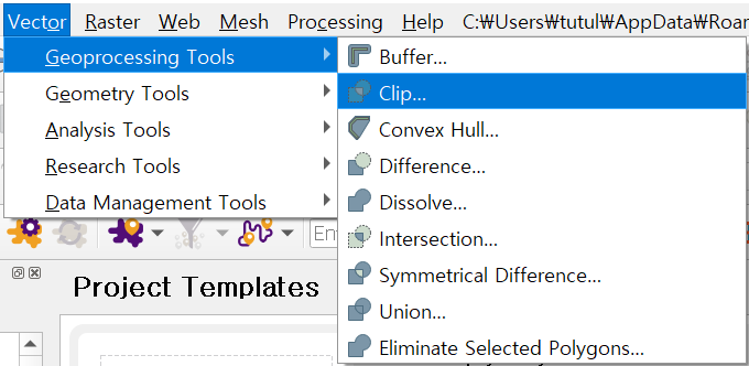
An important commonality between vector and raster layers is that when using the Clip feature, the shape of the area to be cut must be in the form of another file, and this overlay layer must be a vector layer.
Let's illustrate this with an example:
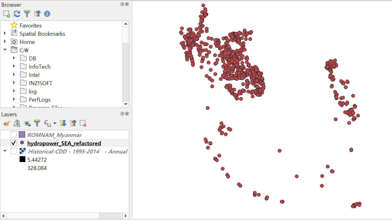
First, let's load a vector layer (Input layer) that we want to clip and another vector layer (Overlay layer) representing the shape of the area we want to clip.
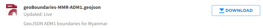
You can download the Myanmar border map from the following link: https://data.humdata.org/dataset/geoboundaries-admin-boundaries-for-myanmar
Myanmar - Subnational Administrative Boundaries - Humanitarian Data Exchange
[{"value": 3, "date": "2023-09-25"}, {"value": 14, "date": "2023-10-02"}, {"value": 28, "date": "2023-10-09"}, {"value": 7, "date": "2023-10-16"}, {"value": 11, "date": "2023-10-23"}, {"value": 7, "date": "2023-10-30"}, {"value": 8, "date": "2023-11-06"},
data.humdata.org
Open the file named "goeBoundaries-MMR-ADM1.geojson" representing the administrative boundaries of Myanmar.
Now, let's open the vector layer of the hydropower plant locations in the Southeast Asia region.
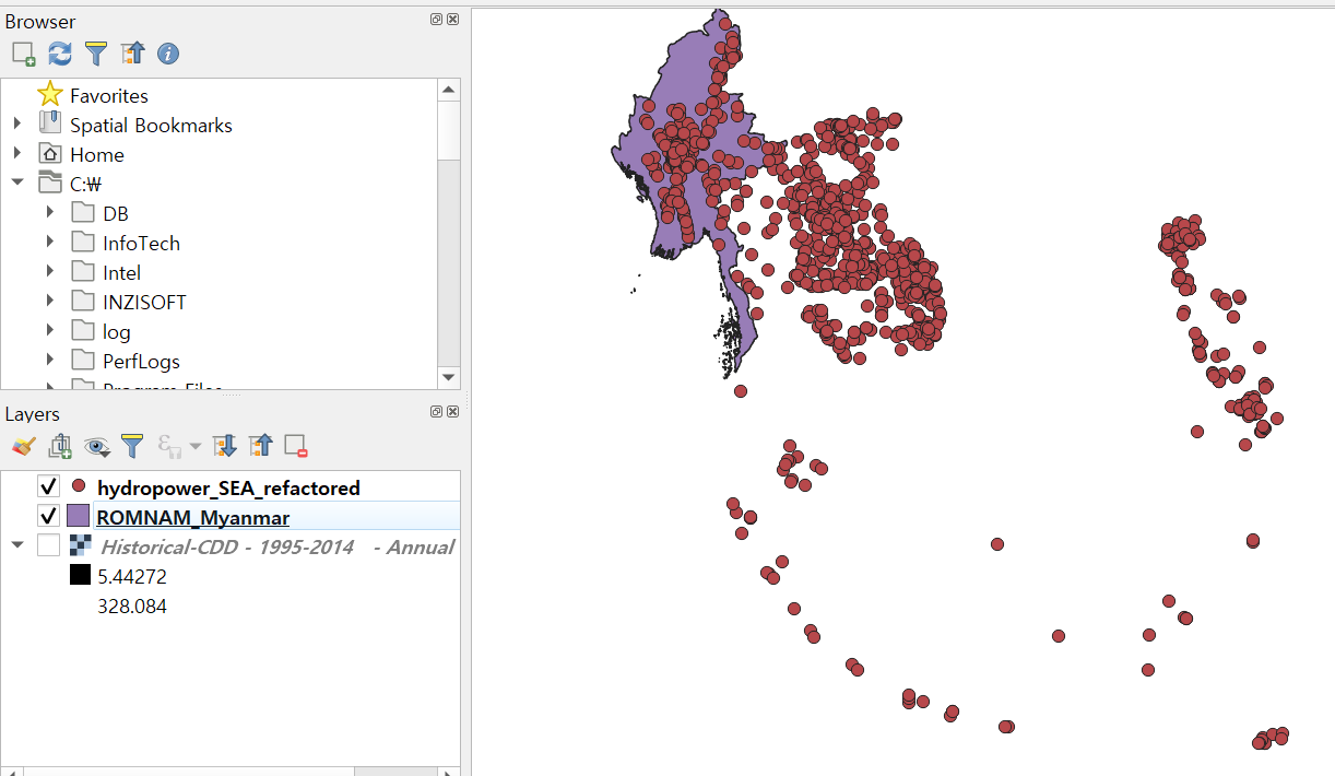
Once both layers are loaded, select the hydropower plant map as the Input layer and the Myanmar border map as the Overlay layer.
Navigate to Vector > Geoprocessing Tools > Clip, select the appropriate layers, and run the tool.
- Input Layer: Hydropowerplant location
- Overlay Layer: Myanmar border map
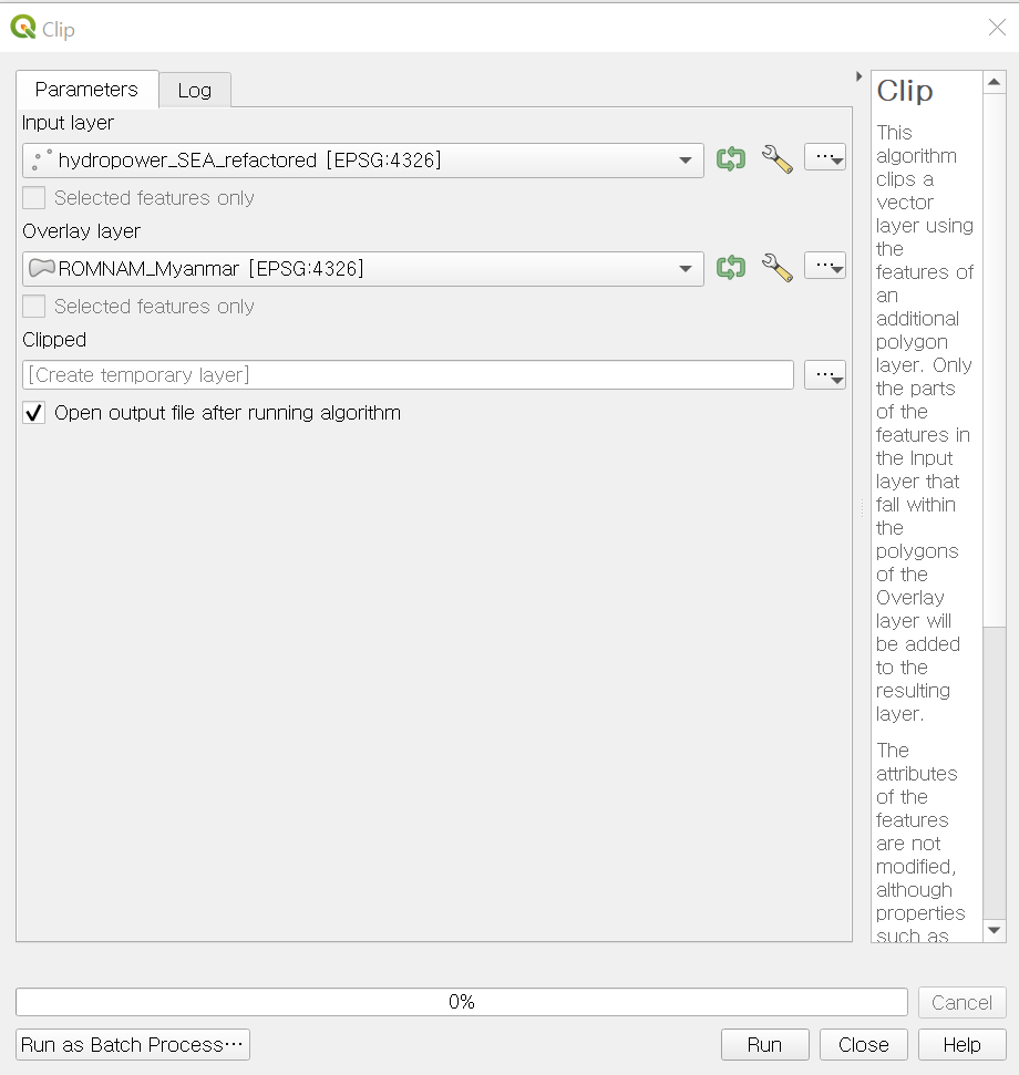
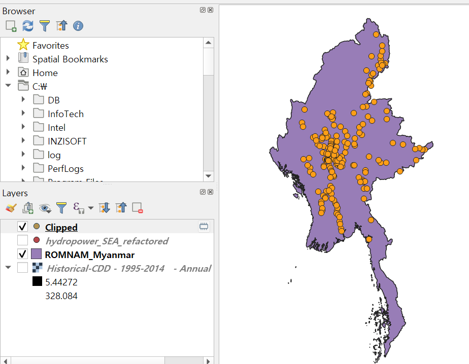
Upon completion, a new clipped layer named "Clipped" will be created, showing only the hydropower plant locations within the boundaries of Myanmar.
That concludes our explanation of the clip method for vector layers.
In the next post, we'll explore how to clip between raster and vector layers.

Thank you.
'English Guidance > QGIS Beginner' 카테고리의 다른 글
| [QGIS Beginner] Toggle Editing Mode (for Vector Layer) (0) | 2024.04.16 |
|---|

댓글